
Funded by
European Commission
V Framework Program Energy, Environment and Sustainable Development |
FORECASTING AT THE REGIONAL SCALE AND
MODELLING AT THE SHELF SCALE - WORKPACKAGE 9 |
|
|
||
|
|||
|
|||
|
MFSTEP ALERMO MODEL 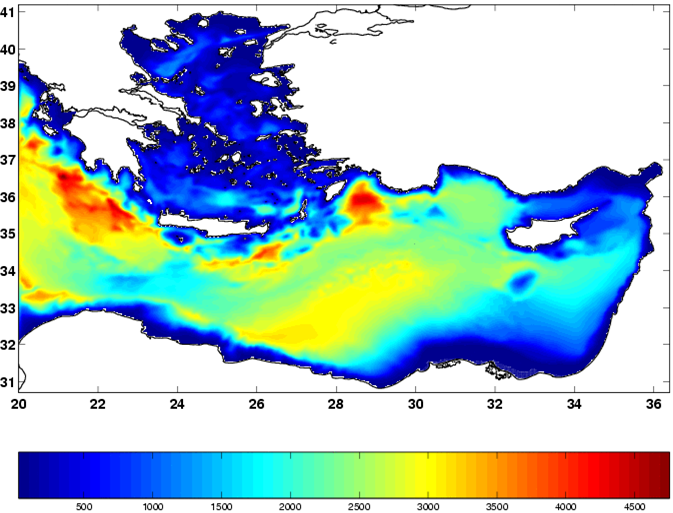
ALERMO Topography
|
 ALERMO Ocean Circulation ForecastingALERMO MFSTEP Manual ALERMO Ocean Circulation ForecastingALERMO MFSTEP Manual  ALERMO MFSTEP Topography and Grid ALERMO MFSTEP Topography and Grid Instructions to read the dataALERMO MFSTEP air-sea coupling code (version 1)ALERMO MFSTEP air-sea coupling code (version 2)ALERMO MFSTEP air-sea coupling documentationALERMO MFSPP dataMFSPP (UAT SITE) Instructions to read the dataALERMO MFSTEP air-sea coupling code (version 1)ALERMO MFSTEP air-sea coupling code (version 2)ALERMO MFSTEP air-sea coupling documentationALERMO MFSPP dataMFSPP (UAT SITE)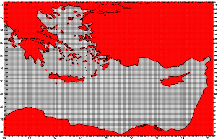
ALERMO Grid |
| |